Satellite data
Excellence in every way
Unique assets
Satellite data have differentiating and/or complementary values compared to other data sources, particularly regarding the large-scale observation of land and how it changes over time, other monitoring activities, etc.
Whether you are an economic, private, public, institutional, scientific, environmental, agricultural, urban actor… these assets open the field of possibilities for many projects.
Global coverage
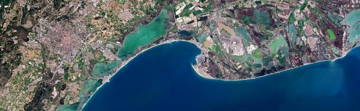
Satellites can capture images of anywhere on Earth. These images are invaluable for monitoring and managing areas that are difficult – or even impossible – to access, such as mountains, seas, disaster-hit areas, deserts, etc.
Cross-cutting
Satellite data are global and cross-cutting in nature: they can therefore analyse areas as a whole, however vast. This enables the study of features such as flood zones, topography, urban sprawl, or changes in land use at a macro scale, disregarding geographical or administrative boundaries. This applies to large areas of all kinds: natural parks, major cities, forests, regions, maritime areas, etc.

Homogeneity
Satellite data have the advantage of being homogeneous: they are comparable, transposable and usable at all levels, regardless of the stakeholder or the software used to manage them.
Many applications for use by local and regional authorities are enabled by satellite data.
Recurrence
To better understand the behaviour of an area or one of its constituent features (water cycle, natural or urban environment, etc.) it is important to understand its history, before human action changes its contours too much. To do this, it is possible to access comparable satellite data that sometimes go as far back as 30 years.
At the same time, recurrent and regular data are important. In this sense too, satellite imagery has an advantage, as images can be obtained with a frequency that can even be weekly in some cases.
Automation
Satellite data enable a wide range of information to be extracted automatically: field surveys, water level simulations, observation of damage caused by weather or natural phenomena, urban sprawl, vegetation cover, identification of tree species, etc. This feature makes it particularly advantageous because it saves time and ensures accuracy.
Responsiveness
During crises or intense weather phenomena, such as floods or fires, it is important to have prompt access to accurate, consistent and reliable information. This has led to the increasing use of satellite imagery, particularly in the case of flooding. There has been a gradual transfer of technology to space solutions as they have become more responsive and less costly.
For which areas?
Space solutions can be applied to areas of all types, whether coastal, rural, urban or mountainous.
Numerous applications have been developed for regional development, environmental monitoring, crisis and risk management, mobility, etc. They can also be applied to different territorial levels, from federations of municipalities up to regions.
- The implementation of the French NOTRe and MAPTAM Acts has strengthened local and regional authorities' powers in spatial planning, mainly through the drafting of regional development frameworks, sustainable development and equality of territories (SRADDET). These powers should be applied to territorial issues relating to urban and suburban areas, rural development, the seafront and coastline, mountain areas and the French overseas territories.
Space solutions also respond to these demands, with the aim of supporting public action and sustainable regional planning and optimisation.
Sentinel satellites now scan the entire planet every five days, providing more than 12 million images of the Earth every day, which is a real goldmine of free information at the disposal of local and regional stakeholders.