GeoDataDays : space in the spotlight!
Actualité -
A unique space trail
For the 2021 edition, the Connect by CNES and GeoDataDays teams are joining forces to offer you a new "space trail" drawn within the event.
It will illustrate the debates, major themes and other highlights of GeoDataDays, to help you discover the potential of satellite services for the benefit of territorial management.
A true showcase of current technologies and solutions, future trends and the know-how of the industrial community, this unique space trail will be rich in several interventions carried out by Connect by CNES, its partners and the space companies sponsoring the event. On the program...

Great debate "Data of general interest
Wednesday 15.09.21 - 10:15-12:00
Jacques BEAS-GARCIA, head of the Connect by CNES program and an expert in spatial data, will give you an analysis of how spatial data fully integrates the concept of "data of general interest", at the heart of the State's "data" strategy.
A specific focus will be dedicated to the concrete capacities of spatial imagery for territories, and to the perspectives it will open in the very near future.
Round table "Spatial and natural spaces - better knowledge for better management
Wednesday 15.09.21 - 13h45-15h15
During the day, Earth observation satellites monitor all kinds of natural areas. At night, they look at areas impacted by light pollution. This round table will address in a simple and direct way the capabilities of space to serve...
- Green (forest, vegetation, natural parks...),
- Blue (coastline, continental waters, wetlands...),
- Black (light pollution).
To fuel a constructive debate, it will alternate testimonies of institutional users and operational service providers.
GeoEnterprise Workshop
Thursday September 16th - 11:15-12:45
The "GeoEnterprises" workshop is organized to present the different ways of supporting companies in the service of territories.
Jacques, our program manager, will make a presentation of Connect in pair with Murmuration, one of our companies that has benefited from different support, which will give us a feedback.
"Spatial and territories - the solutions" Workshop
Thursday 16.09.21 - 14h00-16h00
Today, satellites continuously scan all types of territories, with an increasingly fine resolution. Tomorrow, innovation will push these achievements even further: improved resolutions, 3D images... What if there was a mine at hand? This is the question that will be addressed during this workshop, particularly from two angles:
- The city that breathes, or how space contributes to better manage urban heat, air pollution and demographic/tourist pressure.
- The reclaiming of landscapes, to understand the contribution of space to the management of water reserves, hedgerows or snow.
Spatial village
A concentration of players to highlight existing solutions and major suppliers!
We will of course be at the heart of this space, alongside our companies (E2L, MEOSS, Murmuration, PixStart, SGEVT, WaltR, Resallience, Epleï) and other sponsors of the event (CLS, Gisaïa, ID-GEO, Data Terra and Theia, Minalogic, Kermap ...) to, together, promote the ecosystem to the actors of geographic information.
We will be happy to meet you during the event to exchange with you, to bring you answers... and to make the space grow in your ideas!
#geodata #spatial #territories #innovation
Our news
27 Sep 2021
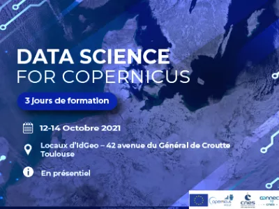
Data Science for Copernicus
Training
For the second time this year, Connect by CNES, Aerospace Valley and Id-GEO are organizing a …